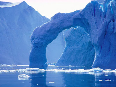
Greenland is the world's largest island & its melting with an area of over 2 million square kilometers; however, much of the island is covered by an ice cap that can reach thicknesses of 3 kilometers.Its northerly location, at the point where the Atlantic meets the Arctic Ocean, means that Greenland is surrounded principally by cold ocean currents, so the coasts are constantly being cooled. This, combined with the radiation of cold from the inland ice, gives Greenland its arctic climate.
Formerly a province of Denmark, it gained the status of an autonomous Danish dependent territory with limited self-government as well as its own parliament in 1979.
The ice cap or inland ice covers 1,833,900 square km, equivalent to 85 percent of Greenland's total area, and extends 2,500 km (1,553 miles) from north to south and up to 1,000 km from east to west. At its center, the ice can be up to 3 km thick, representing 10 percent of the world's total fresh water reserves.If all the ice were to melt, the world's oceans would rise seven meters.
Here are few pictures & description on Greedland Melting.
Greenland's Ice Sheet is undergoing massive changes, including melted lakes on the surface and holes in the overflow channel leading to a moulin, a crevasse through which water enters a glacier bed from the surface.
Scientists discover large holes on the surface of Greenland's Ice Sheet, which can shift vertically and horizontally as a result.
Melted ice can be seen on the surface of the ice sheet.


No comments:
Post a Comment